Backcountry Electronics Revisited – 5 years later

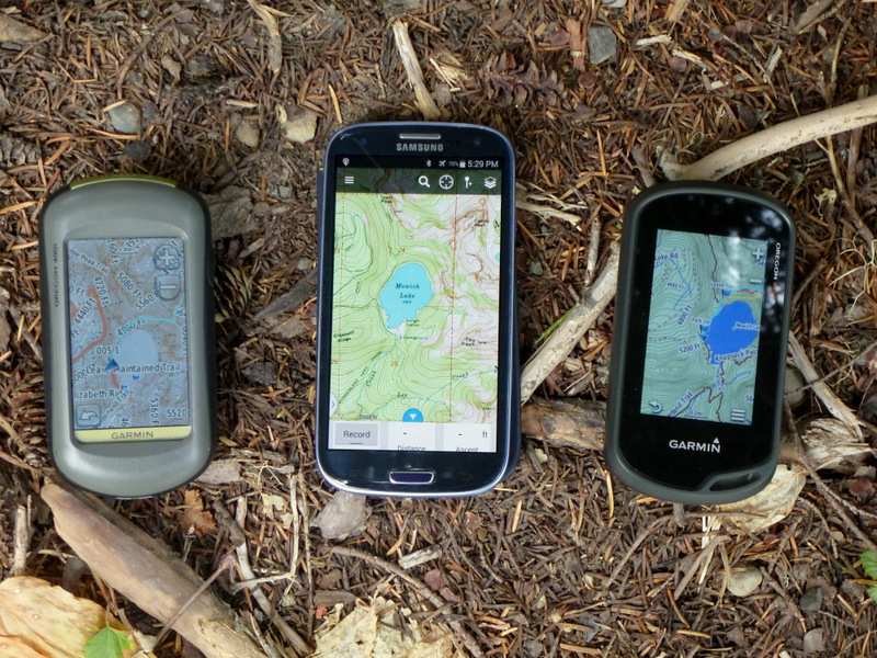
Guess what, 5 years later I am on another generation of backcountry tech devices.   Back then, I was carrying a Spot Connect satellite communicator, a Samsung Galaxy III smart phone and a Garmin Oregon 400 handheld GPS.  I still carry the same 3 functions, but now it’s a new Garmin InReach Mini, a Galaxy 7, and an Oregon 600.  And, no surprise, they are better. The GPS and smartphone were replaced as they died or aged.  The new Garmin satellite communicator just out performed the competition.
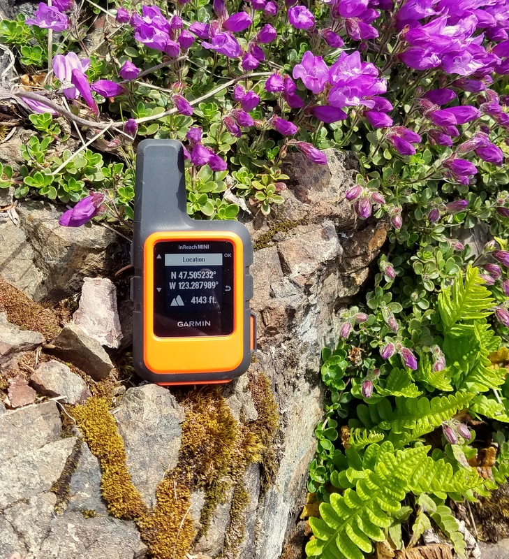
Garmin InReach Mini

The InReach Mini gives me two way SMS communication, which is the new standard for backcountry satellite devices.  Emergency notification with location (“calling in the cavalry”)  was the first popular backcountry satellite application and still remains an important, if hopefully infrequently used, function. Now having been on the receiving end of one of these contacts, I can say that it is useful, but still leaves lots of room for confusion.  Being able to confirm and detail the nature of the emergency and have two way communication with responders makes life better and safer for all concerned.  Expanding that two way capability to ordinary messaging offers a new level of utility.  Both current SPOT and Garmin InReach devices do this.  For higher annual subscription costs, you can also add connection to social media and location tracking.  But I am quite happy with a basic level plan.  Compared to the SPOT X communicator, the InReach Mini is a hands down winner and when my annual SPOT contract was up, I switched. Continue reading

Should Fire be a 10th Essential?

FireYou’re lost. You’re cold.  You’re wet. You’re not going to get out of the woods soon.  What’s your plan?  Of course, you need to build a fire!  Good idea?  Bad idea?

Making an emergency fire has long been one of the pillars of wilderness survival response.  The ability to do this is codified in the Mountaineers 10 Essentials List.  After watching big chunks of the west burn during our exceptionally dry summer, it might be time for a “reboot”. Continue reading

GPS trials

Garmin or Android

Oregon 400i – Samsung Galaxy SIII – Oregon 600

A lot our adventures leave developed trails and follow informal boot paths, or sometimes no paths at all. Our terrain is frequently heavily wooded or high relief, so that visual navigation is restricted. We use our GPS’s a lot.

I have always used a handheld Garmin unit.  But lot of my friends have switched to GPS applications on their smart phones.   I wondered if I was missing something.    So this spring I put the smart phone GPS app approach to some real world testing. Continue reading

My first unplanned overnight, ever

Unplanned bivyIt wasn’t an emergency situation.  But the reason we all carry (or should carry) The Ten Essentials is that some days do not go according to plan.  The previous summer we seriously underestimated the length of a long alpine scramble in Mt. Rainier National Park and turned around at 2 in the afternoon with a lot of mountain still above us.  This year we started up from base camp much earlier and had better luck with the obscure route finding challenges.  It was still 3 pm when we got on top.  At 7 pm my partner announced that we were at a good spot to bivy.  We were in open woods by a little stream.  I was still intent on getting down that day, but he was correct.  We found a couple of nice level spots for “camp”.  He often does “day and a half” outings, so he just got out his overnight bivy gear.  I got out my Ten Essentials stash.  For 40 years I had been having this conversation on outings – “What if we had to spend the night?  Would you be O.K. with what you are carrying right now?”  Now I was actually going to find out. Continue reading

Route finding

RoutefindingAs readers will have noticed, it has been a while since I made my last post.  There are several reasons.  I finished most of the topics I originally outlined to cover lighter weight backpacking.  I haven’t had any recent suggestions of additional items to include.  And I have been out peakbagging, as suggested by my last post, Fast and Light.

A lot of trips I am doing now have some element of off-trail travel.  Sometimes it goes better than others. On these trips I will have a destination, typically a peak, a topo map of the area with the suggested off-trail route superimposed on it, and the same suggested route loaded on my GPS with its topo background map.  That’s quite a lot of information.  But still I am impressed by the number of route finding decisions I make continuously trying to get from here to there.

I know generally where I want to go, following a compass or GPS heading.  I now have to find a way to get there, which may involve several steps of decreasing scale, right down to the level of where my foot goes next.  In our big timber, 50 yards is a good range over which to survey the next piece of route. But within that distance there may several obstacles to avoid, such as a fallen 4-6 ft. log, a rock nose or gully.  Even closer in, you need to avoid holes, slippery sticks or stands of dense small trees.  At the same time taking care not to wander off your general track. This requires a lot of concentration.  Chatting with a hiking partner often leads off track quickly.

Some recent trips provide examples of route finding challenges. Continue reading

Please don’t feed the bears

Black bearKeeping critters out of your food will make both you and the critters happier.  It’s not just bears that shouldn’t be fed, but mice, racoons, birds, squirrels, fox and possibly even mountain goats.  It’s been over 40 years since I lost anything to bears and I intend to keep it that way.

I see bears a lot when hiking in both Olympic and Rainier National Parks.  The encounters are typically non-threatening and we go our separate ways, but it is pretty clear that they are around.  I have actually had more problems with mice than bears.  Mice have chewed holes in a tent zipper and a “rodent proof” food bag.  So I try to keep a clean camp and carefully hang my food or store it in a bear canister. Continue reading

Clean water

Clean waterWe really did drink right out of streams, decades ago.  When the general practice of purifying drinking water started, we used iodine tablets or boiling.  The arrival of pumped filters was revolutionary.   Now many more choices of water purification are available, at much lighter trail weights.

As I focused on reducing my load, I switched from a pumped filter to Aqua Mira.  This is a two part chlorine dioxide water purification system.  You add the prescribed number of drops from vial A and vial B to a mixing cup.  You wait 5 minutes for the mixture to turn yellow and then add it to your water.  In 30 minutes the water is safe to drink, unless the water is really cold.  It is effective and low cost.  Two full bottles, with mixing cup weigh 3 oz. and cost under $15.  It will last for a season or more – 30 gallons.  You can save even more weight by buying two very small dropper bottles to carry instead the full sized ones.  I used this system for a season, but didn’t like the counting of drops, especially when treating 3 quart batches and then sitting around for 5 minutes for the mixture to activate.

I found an equivalent product in tablet form, now sold as MSR Aquatabs.  One very small tablet will purify up to 2 quarts of clean water.  Continue reading

Backcountry electronics

Garmin OregonBackcountry electronics might seem like a contradiction.  After all, don’t we go to the woods to get away from all that stuff?  Still the power and productivity electronics provide us today can be persuasive.

In the backcountry,  I supplement my navigation with GPS and I use satellite connection for emergency and routine location reporting. Continue reading