
 As readers will have noticed, it has been a while since I made my last post. There are several reasons. I finished most of the topics I originally outlined to cover lighter weight backpacking. I haven’t had any recent suggestions of additional items to include. And I have been out peakbagging, as suggested by my last post, Fast and Light.
A lot of trips I am doing now have some element of off-trail travel. Sometimes it goes better than others. On these trips I will have a destination, typically a peak, a topo map of the area with the suggested off-trail route superimposed on it, and the same suggested route loaded on my GPS with its topo background map. That’s quite a lot of information. But still I am impressed by the number of route finding decisions I make continuously trying to get from here to there.
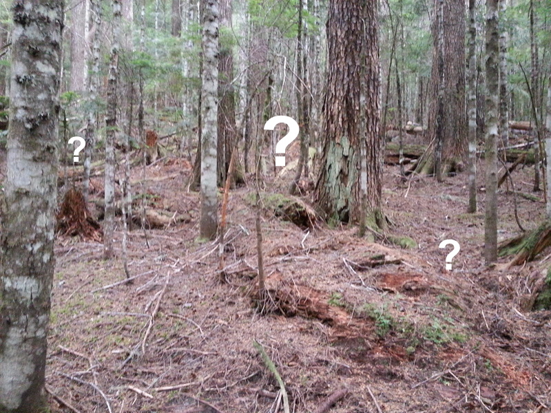
I know generally where I want to go, following a compass or GPS heading. I now have to find a way to get there, which may involve several steps of decreasing scale, right down to the level of where my foot goes next. In our big timber, 50 yards is a good range over which to survey the next piece of route. But within that distance there may several obstacles to avoid, such as a fallen 4-6 ft. log, a rock nose or gully. Even closer in, you need to avoid holes, slippery sticks or stands of dense small trees. At the same time taking care not to wander off your general track. This requires a lot of concentration. Chatting with a hiking partner often leads off track quickly.
Some recent trips provide examples of route finding challenges.
I climbed a peak in the southeast quadrant of Mount Rainier National Park. The approach was along the Wonderland Trail, with the final 3/4 mile off-trail. I had no overall view of my destination due to tree coverage. I had a GPS waypoint where I wanted to leave the trail and head cross-country towards the peak. The off-trail route descended to a saddle and then climbed a ridge to the summit. I looked for a way trail or boot track, often present on popular peaks. I saw one early, but it was not really in the right place and did not continue far. Eventually I just headed off downhill in open grassland towards the peak, not waiting to get to the waypoint. I needed to find the ridge toward the saddle, so my first challenge was picking the direction that went to the saddle rather than just downhill. With a GPS track or even a compass, this is pretty easy, but soon I recognized the shape of the ridge emerging in the land under the tree cover – a flatter downhill section with steeper drop offs on each side. In general off-trail, ridges are your friend. They present the lowest slope angle going up or down. Visually following the terrain, near the saddle I picked up a boot trail. Across the saddle, the boot trail was lost among game trails, but I just needed to go up. With just a little bush bashing, I found my way to the summit – pretty easy pickings.
Going down is different. On the way up, all paths lead to the summit. Coming down, only one direction is the right one. Getting off route on the way down is a classic mistake, that I have made on occasion. On the other hand, looking downhill gives a better overall view of your options and picking a good line is easier. Quite frequently on the way down you find the boot trail that you missed on the way up. On this peak my topo, a compass bearing and uphill GPS track showed the route and I picked up the boot trail again. It finally wandered off to the north, where I wanted to go south. I turned left to intersect the Wonderland Trail about where I started. All in all a route finding exercise with very little drama.
The next peak was a significantly larger challenge. Again trees covered the route was almost completely, with no views of the summit for orientation. The off-trail portion consisted of about a mile with 2,100 ft. elevation gain, pretty steep. On this peak, the suggested GPS route headed up a gully. I wondered about this, as our gullies are usually water drainages, full of brush, including a locally distinct spiky plant called Devils Club. I intentionally stayed to the edge of the gully in more open forest. Soon I encountered a rock nose blocking the ridge. Ah ha, that’s why the route stays in the gully. But I wondered if if there was a way around the nose. I checked. The back side of the nose was too steep, but just at the face I spotted some slots angling up through the rock. Then I saw I was standing on a boot track leading up one of the slots – problem solved, others have been this way. Above the rock nose, the boot track continued up the ridge, as it should. I followed it for most of the rest of the peak. Coming down, my GPS track lead me successfully back to the top of the rock slot and I eventually emerged on the trail out. My take-away lessons from this were that it pays to look around a little before committing to a difficult route choice, and that my GPS is a critical piece of navigation gear.
This last observation bothered me a little. My GPS has been very reliable. I do have battery life issues occasionally and I have swapped batteries among devices to keep the GPS running when I need a few more hours. But still, stuff happens. Of course I have a topo and a compass, but you really have to know where you are for those tools help. In forest cover, there are no bearing options for location. I use my GPS to provide elevation as well, but again if the GPS stops… I needed some navigational redundancy. In the vertical terrain in which I travel, elevation, and the compass heading of the slope can often pinpoint your location on a topo. A little web searching found a reasonably priced Casio watch with barometric elevation display. It tracks elevation pretty well. Recalibration against a topo is easy when you arrive at known locations. Keeping track of elevation on my wrist rather than by pulling out my GPS gives me a closer idea of progress as well. It’s a good safety addition for no added weight.

Thank youu for sharing